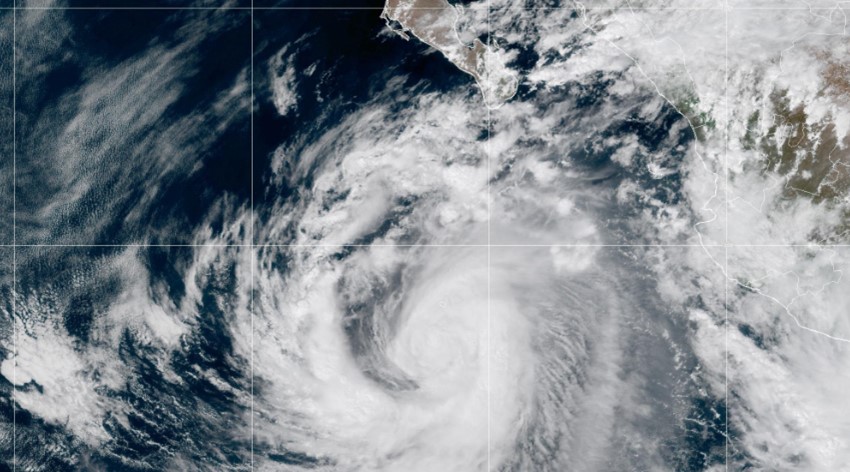
Lidia made landfall Tuesday in the state of Jalisco, Mexico, as an “extremely dangerous” category 4 hurricane, causing strong winds and heavy rains in the area, according to the National Hurricane Center. It also threatens significant flooding.
The center of the hurricane, with maximum sustained winds of 225 km/h, impacted near Las Peñitas in the municipality of Tomatán, Jalisco, shortly before 6 p.m. local time (8 p.m. ET), according to the hurricane center.
What locations are threatened by Hurricane Lidia?
Lidia is expected to dump 10 to 20 cm of rain in the region, and even up to 30 cm in some areas, which will likely cause flash flooding and landslides, the entity warned.
As it moved across the eastern Pacific, Lidia strengthened at full speed and reached Category 4 strength.
“A dangerous storm surge is forecast to produce significant coastal flooding near and south of where Lidia made landfall. Near the coast, the storm surge will be accompanied by large and destructive waves,” the hurricane center said.
Meanwhile, Mexico’s National Meteorological Service (SNM) reported that the center of Lidia is located 25 km south-southeast of Cabo Corrientes and 55 km south-southwest of Puerto Vallarta, both locations in Jalisco.
Lidia is moving east-northeast at about 25 km/h, with hurricane-force winds extending 48 km/h away. The center of Lidia is expected to move inland over west-central Mexico Tuesday night and Wednesday morning.
The National Water Commission (Conagua) informed in a statement that, as a result of Lidia, extraordinary rains are expected in Colima, Jalisco and Nayarit, as well as torrential rains in Guerrero and Michoacán, which could generate landslides, an increase in the level of rivers and streams, and overflows and floods.
In a press release, the Mexican Government, through the National Civil Protection Coordination, called on the population to take extreme precautions due to precipitation that will cause “reduced visibility, landslides, puddles or floods, as well as an increase in the levels of rivers and streams”. Authorities also recommended taking shelter in safe places, avoiding water crossings and the proximity of hillsides, as well as staying away from windows and structures that could pose a risk.
Mexican President Andrés Manuel López Obrador wrote on his X account (formerly Twitter): “I call on the population of the borders between Nayarit and Jalisco, especially Bahía de Banderas, Puerto Vallarta and Tomatlán, to take precautions due to Hurricane Lidia (…) Plan Marina and Plan DN-III-E have already been activated. There are elements of the Armed Forces and Civil Protection in the area. However, it is necessary to take refuge in safe places; stay away from low areas, streams, rivers and hillsides”.
For this Wednesday, October 11, Conagua forecasts very heavy rains in Chiapas, Guerrero, Jalisco, Michoacán, Nayarit, Nuevo León, Oaxaca, Sinaloa, Tamaulipas and Zacatecas; heavy rains in Coahuila, Colima, Durango, State of Mexico, San Luis Potosi and Veracruz; showers in Aguascalientes, Campeche, Chihuahua, Mexico City, Guanajuato, Hidalgo, Morelos, Puebla, Queretaro, Quintana Roo, Sonora, Tabasco, Tlaxcala and Yucatan.
TYT Newsroom


