

Tropical Storm Rina formed on Thursday, September 28th in the Atlantic Ocean, not far from Tropical Storm Philippe. Forecasters from the National Hurricane Center say the two systems might begin to interact with one another as they spin in the open ocean far from land, in a complex dance − almost like a square dance − known as the Fujiwhara Effect.
According to meteorologist Matt Lanza’s blog The Eyewall, “the two systems would track close enough to one another to impact each other’s track.” In this case, Philippe would likely slow, stall, or get pushed to the south since it’s ahead of Rina, and Rina would basically slingshot over the top of Philippe either west or northwest and out to sea, he said.
Miami-based meteorologist John Morales, writing on X, said the two storms are now separated by less than 700 miles and that “they’re expected to pivot around each other, with one becoming more dominant. Now, neither is expected to hit the Caribbean.”
What is the Fujiwhara Effect?
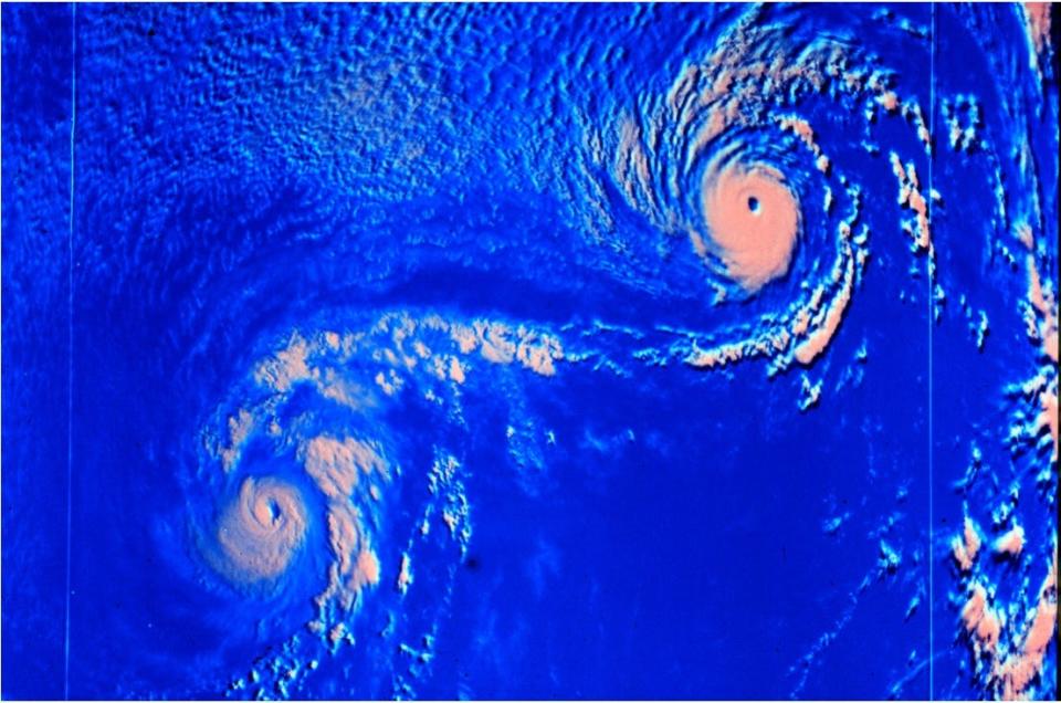
Basically, the Fujiwhara Effect describes the rotation of two storms around each other. It’s most common with tropical cyclones such as typhoons or hurricanes, but it also occurs in other cases.
When two hurricanes spinning in the same direction pass close enough to each other, they begin an intense dance around their common center, the National Weather Service said.
The effect is thought to occur when storms get about 900 miles apart.
Square dancing and ice skaters
Storms involved in the Fujiwhara Effect are rotating around one another as if they had locked arms and were square dancing. Rather than each storm spinning about the other, they are actually moving about a central point between them, as if both were tied to the same post and each swung around it separately from the other.
A good way to picture this is to think of two ice skaters who skate quickly toward each other, nearly on a collision course, grab hands as they are about to pass and spin vigorously around in one big circle with their joined hands at the center.
The effect is named after Dr. Sakuhei Fujiwhara who was the chief of the Central Meteorological Bureau in Tokyo shortly after the first World War. In 1921, he wrote a paper describing the motions of “vortices” in water. Water vortices, such as whirlpools, are little water whirls that spin around.

What is the path of Philippe and Rina?
The National Hurricane Center, in its 5 p.m. ET forecast discussion for Tropical Storm Philippe, said that its “trackforecast is challenging, in part due to Philippe’s close proximity to Tropical Storm Rina.” During the next few days, Philippe will likely move slowly southwestward as it rotates around Rina currently to its east, the hurricane center said.
As of Thursday evening, the center of Philippe was located 525 miles east of the northern Leeward islands. It had winds of 45 mph and was crawling along at 2 mph.
As for Rina, the tropical storm is moving northwestward, with a forward speed near 14 mph. Rina “should begin to turn more westward today and continue this general motion for the next several days.”
“Confidence in the track forecast (for Rina) is lower than normal based on the model spread and uncertainty regarding the potential interaction with Tropical Storm Philippe during the next several days,” the hurricane center said.
No coastal watches or warnings are in effect for either storm, and there were no hazards affecting land.
Track Tropical Storm Philippe

Rina is the 18th storm of the season
Tropical Storm Rina is the 18th Atlantic named storm of the 2023 Atlantic hurricane season, said Colorado State University research meteorologist Phil Klotzbach, on X. “That’s the 3rd-most on record through September 28, trailing 2020 (23 named storms) and 2021 (19 named storms).”
TYT Newsroom

1 comment
A highly organized and detail oriented Remote Data Entry Assistant is needed at our company to work with our team of professionals to collect. analyze and input Data into our online systems and Social Media sa-02 platforms. This is a remote position and full-time or Half-time job.
.
.
For Apply Click——————————–>>>https://buildyourbiz1.blogspot.com/