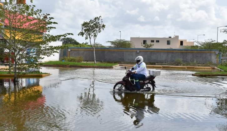
MÉRIDA, YUCATAN (November 4, 2020).- The floods that prevail in different areas of the State would continue until February 2021, since with the presence of La Niña, tropical waves will continue to arrive at the Yucatan Peninsula, predicted the member of the Institutional Committee for the Attention of Extreme Meteorological Phenomena (Ciafeme) from the Autonomous University of Yucatán (UADY), Juan Vázquez Montalvo.
The situation is complicated since “the cold fronts are strong”, and the impact is remarkable, both in terms of rain and winds.
Worst of all, “the water table is already saturated”, which has caused numerous floods in areas of Méridas such as Las Américas and Ciudad Caucel, as well as the Poniente Ecological Park, and various cenotes.
For all these reasons, floods will prevail for up to three months, that is, the streets will be dry until February 2021, as long as there are no more heavy rains.
It is worth mentioning that these days the effects of a category 4 Eta hurricane will be felt in the Yucatan Peninsula, which has already entered Nicaragua, and as it passes through Central America it will degrade to a tropical depression, but when entering the Caribbean Sea again, it could regain its strength as a tropical storm.
Even, according to the National Meteorological Service (SMN), at least for today, “the extensive circulation of Eta in combination with cold front number 11 produces scattered rains in the Yucatan Peninsula.”
Vázquez Montalvo explained that all these natural phenomena are caused by “La Niña”, which appeared last September and will prevail for at least one more month.
With the arrival of La Niña, the climatic condition was modified both at the level of high temperatures and very strong low water (water level), among other events that cause greater cyclonic activity for the Atlantic Ocean.
“The period of appearance of the tropical waves should have concluded on October 15, but they continue to arrive,” said the UADY specialist.
The Tropical Cyclone Season continues for the Atlantic Ocean, Gulf of Mexico and the Caribbean Sea, which began on June 1 and will end on November 30.
The El Niño Southern Oscillation (ENSO) phenomenon is a warming of the surface waters of the central-eastern region of the Pacific Ocean, predominantly in the equatorial strip, and normally, the winds blow from the east, pushing the warmer waters towards the sector. west of the sea, but this hydrometeorological event causes the air to recur until it reaches the tropical strip.
Normally, seawater is cold and rich in nutrients, but when El Niño occurs, it becomes warm, causing a reduction in marine plant and animal life.
The opposite phenomenon is La Niña, which appears as a cooling of the waters of the equatorial strip of the Pacific, which inhibits the formation of clouds, and causes a lack of rain.
The opposite occurs in the Atlantic Ocean since its waters become warm and evaporation is greater, therefore, the formation of clouds.
The Uady academic explained that La Niña can have a presence of two years, and then disintegrate and cause the appearance of ENSO or allow the prevalence of a neutral year.
He noted that in 2021 a notable cyclonic activity is also expected for the Atlantic, according to the forecasts.


