
MÉRIDA, Yucatán.- Given the proximity of the tropical storm “Zeta”, which is expected to enter the Yucatán Peninsula as a category 1 hurricane, the meteorologist from the Autonomous University of Yucatán (UADY), Juan Vázquez Montalvo, called to take precautions against the rains that will be generated in the state.
He indicated that adequate conditions are still maintained for tropical cyclones to be generated: “the Caribbean Sea is still above 30 ° C, a temperature that is like fuel for these natural phenomena.”
Regarding why cyclones are approaching Yucatan, instead of heading north or northeast, the expert explained that cold front activity has been very low for the Peninsula.
“Storms have reached the north of the country and the Gulf of Mexico, areas in which they have stayed, so the cold fronts season is not active, therefore the water in the Gulf remains warm.”
He indicated that as long as the strong cold fronts do not reach the Peninsula “we will be at risk”, he also recalled that the hurricane season could not end on November 30th, but extend for one or two more months.
Regarding tropical storm “Zeta”, which currently has sustained winds of 110 km / h, he said that it is expected to have a slow movement towards the northwest, in addition to being an erratic cyclone.
Vázquez Montalvo explained that “Zeta” will become a hurricane this afternoon and could reach category 2.
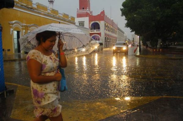
Areas flooded by “Gamma” and “Delta”, will be affected again by Zeta
He indicated that the danger of the approaching meteorological phenomenon is not in its winds but in the amount of water it will bring to areas still flooded by the rains generated by “Gamma” and “Delta”, such as some parts of Mérida and municipalities in the eastern part of the state.
“This cyclone moves very slowly, so it generates a significant accumulation of water on its way. The expert declared that “Zeta” will bring torrential rains to Yucatan from tonight until Wednesday.
He explained that the phenomenon presents a large cloud cover, since it even covers the entire Yucatan Peninsula, so its rains are dispersed throughout the state.
The expert indicated that the rains will worsen and these will be more intense on the night of Monday, October 26th.
He affirmed that “Zeta” will enter Yucatán at dawn, it is expected to be between 2:00 and 3:00 when he enters through Chemax.
Between 6:00 am and 7:00 am, it will leave the continental territory between Dzilam Bravo and Telchac Puerto.
Vázquez Montalvo indicated that although Zeta leaves the Yucatecan territory tomorrow, the rains will continue until Wednesday night.
