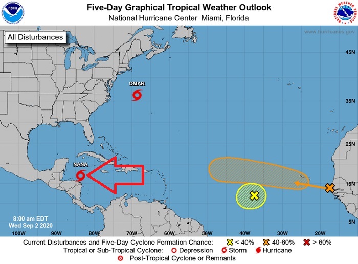
The fifth hurricane of the 2020 season is likely to form by Wednesday night as Tropical Storm Nana makes its approach toward Belize, the National Hurricane Center said.
The forecast track projects that Nana will pass north of the coast of Honduras on Wednesday. before making landfall on the coast of Belize on Wednesday night or early Thursday, according to the NHC’s public advisory.
Nana is expected to hit Belize as a Category 1 hurricane, and wind shear is expected to limit its intensity, according to a forecast discussion.
Nana, the season’s 14th tropical storm, formed Tuesday about 120 miles south-southwest of Kingston, Jamaica.
As of 11 a.m., Nana was about 145 miles east-northeast of Isla Roatan, Honduras, and about 240 east of Belize City, moving west at 17 mph with top winds of 60. A Category 1 hurricane forms when sustained winds are in the range of 74 to 95 mph.
Tropical-storm-force winds extend outward up to 70 miles from Nana’s center, the hurricane center said.
The entire coast of Belize is under a hurricane warning and a hurricane watch. Northern Honduras and coastal Guatemala are under a tropical storm watch and the southern Yucatan Peninsula is under a tropical storm warning.
There have been four hurricanes so far in this busy Atlantic season: Hanna, Isais, Laura and Marco.
Laura was the season’s first major hurricane, making landfall in Cameron, La., as a Category 4 on Aug. 27. Hanna, Isias and Marco were Category 1 hurricanes that made landfall in Padre Island, Texas; Ocean Isle Beach, N.C.; and at the mouth of the Mississippi River, respectively.
Meanwhile, Tropical Storm Omar has encountered storm-weakening, upper-level winds over the open Atlantic that are diminishing the storm.
Omar, the season’s 15th tropical storm, formed about 225 miles east of Cape Hatteras, N.C., on Tuesday, about five hours after Nana, according to the NHC.

Tropical Storm Omar was about 315 miles north-northwest of Bermuda, the NHC said Wednesday in its 11 a.m. advisory. It was moving east at 14 mph, with 40 mph winds and higher gusts. It is not expected to strengthen much and it is likely to significantly weaken throughout the day on Thursday, becoming a remnant low by Thursday night, the NHC said in its outlook.
The system is expected to continue its curve away from land, moving in a northeast to eastward motion off the U.S. East Coast.


